GeoXray

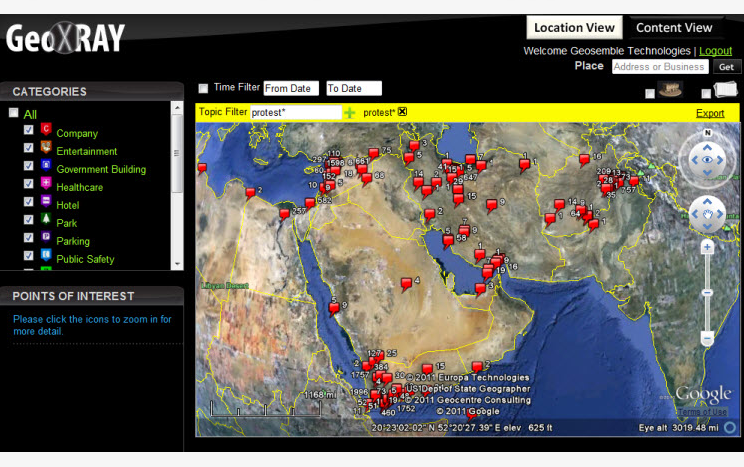
GeoXray is a service that allows users to view articles, documents, and other information in a spatial context. This is meant to be ran as an internal platform for agencies to compile and view data they may want to keep private.
My work on GeoXray was mostly integrating various web services into the product, as well as adding various account settings for admins and users. Some examples:
-Allowing users to add a Wikimapia feed for an area.
-Adding a time slider that allowed chronological display of map layers. This allowed users to see how an area changed over time, satellite imagery was provided from a third-party web service.
-Allowing users to load various geospatial files and databases into GeoXray, allowing a ton of private data to be added quickly
-Integrating a web-scraper page that allowed users to compare original pages with their scraped contents side by side.
-Created a digest that would email users periodically about new articles on a particular area.
-Worked on an API that exposed GeoXray functionality to third-party user interfaces.